Skip to content

Suggestions

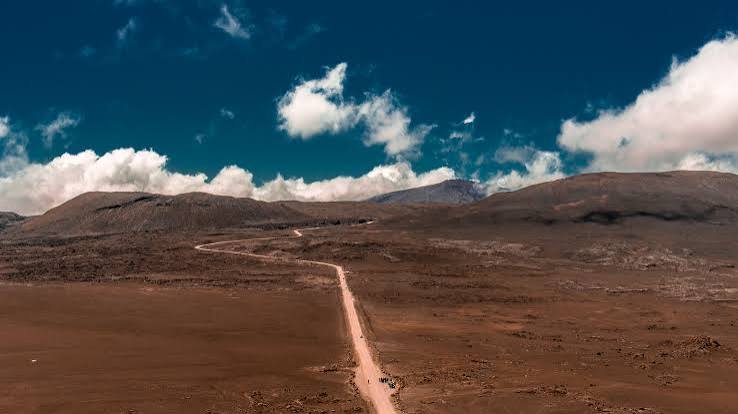
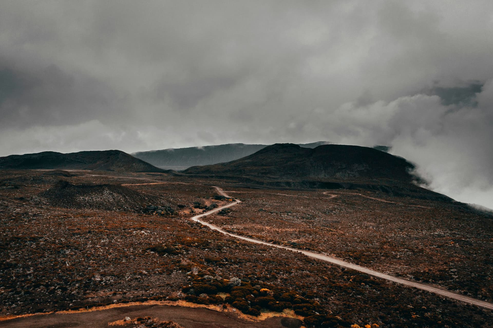
    A track crossing the Plaine des Sables towards the volcano

    Explore

    The living volcano

    Piton de la Fournaise has been shaping the south-east of the island for hundreds of thousands of years. Its story, its eruptions, its trails.

    Access to the Enclos Fouqué (the volcano’s main caldera) can be closed at any time by prefectural order in the event of volcanic activity. Check the guidance from the Volcano Observatory and the prefecture before you set off.

    Piton de la Fournaise
    530,000 years old, active

    01

    Piton de la Fournaise

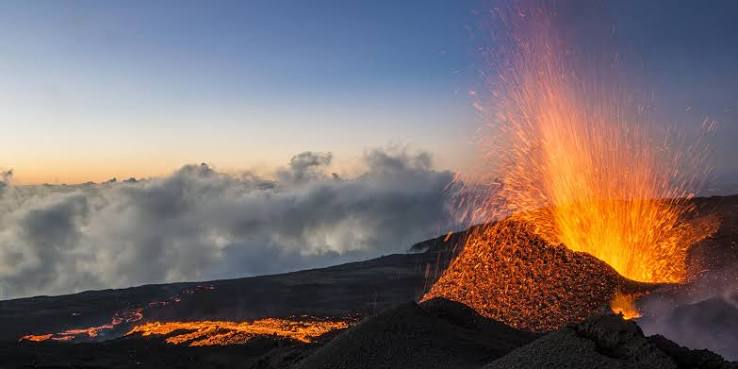
    Born 530,000 years ago, the Piton de la Fournaise erupts on average every nine months, with more than 200 eruptions recorded since the 17th century. It is one of the most active volcanoes in the world, but also one of the most predictable: effusive, with slow-moving lava flows, and monitored around the clock by the Volcano Observatory, which manages to anticipate most eruptions several weeks ahead.

    • 2,632 metres high

      The summit of the volcano, largely open to hikers in calm weather between two eruptions.

    • 2007, the eruption of the century

      The Dolomieu crater collapsed to a depth of more than 300 m; the lava crossed forest, river and the main coastal road before reaching the ocean, around 200 million m³ in total.

    • March 2026, lava back in the ocean

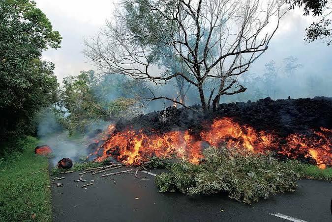
      On 13 March 2026, for the first time since 2007, a lava flow once again crossed the RN2 and reached the sea, cutting the Route des Laves for several weeks.

    Did you know? Despite its frequent eruptions, the Piton de la Fournaise has caused no direct fatalities for decades: its fluid lava always leaves time to evacuate the areas at risk.

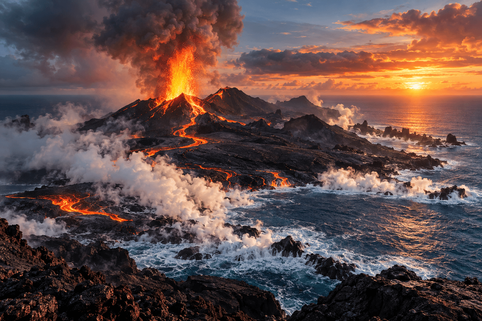
    Photo: Wikimedia Commons · CC BY-SA 2.5

    Piton des Neiges
    3,070 m, extinct for ~12,000 years

    02

    Piton des Neiges

    Older than the Piton de la Fournaise, the Piton des Neiges is now considered extinct: its last known activity dates back around 12,000 years. Its 3,070-metre summit is the highest point in the Indian Ocean, and as it collapsed, the volcano shaped the three cirques (natural amphitheatres) that surround it.

    • The roof of the Indian Ocean

      At 3,070 m, it is the highest point of all the lands bordering the Indian Ocean.

    • A volcano that sculpted the landscape

      As it gradually collapsed over its geological history, its cone gave birth to the cirques of Cilaos, Mafate and Salazie.

    • The ascent

      The summit is usually reached over two days, with a night at the Caverne Dufour gîte before the final climb at sunrise.

    Did you know? Despite its name (“Snow Peak”), it very rarely snows at the summit: the name probably comes from the frost and morning ice observed by the first explorers.

    Photo: Bouba · Wikimedia Commons · CC BY-SA 2.5

    The volcanic birth of Réunion
    ≈ 3 million years

    03

    The volcanic birth of Réunion

    Réunion was born around 3 million years ago from the activity of an undersea volcanic hotspot, the same kind of mechanism that formed Hawaii. Layer upon layer of lava flows eventually broke through the surface of the ocean, giving birth to the island we know today.

    • A hotspot beneath the ocean

      Unlike most volcanoes, the Piton de la Fournaise was not born from a collision of plates but from a fixed plume of magma, above which the oceanic plate slowly moves.

    • Two volcanoes, one island

      The Piton des Neiges appeared first, followed by the Piton de la Fournaise further to the south-east; the two volcanoes gradually merged to form the island as it is today.

    • An island still in the making

      Every eruption that reaches the ocean adds a little more to the island's surface, as in 1986 or 2007.

    Did you know? Much earlier in its history, the same hotspot also created the Mascarene Plateau and even vast volcanic formations now submerged beneath the Indian Ocean.

    Photo: Illustration created for the app · Illustration, not an authentic period photograph

    The great eruptions
    1977 – 2026

    04

    The great eruptions

    More than 200 eruptions have been recorded at the Piton de la Fournaise since the 17th century. A few have left a lasting mark on the island's memory, cutting roads, threatening homes or extending its territory.

    • 1977, lava at the doors of a church

      At Piton Sainte-Rose, the lava flow surrounds the church without destroying it, entering only three metres into the nave. It would be renamed Notre-Dame-des-Laves.

    • 1986, the Grand Tremblet

      A lava flow crosses the road and reaches the ocean south of Piton du Tremblet, adding several hectares to the island.

    • 2007, the eruption of the century

      The Dolomieu crater collapses by more than 300 m; the road stays closed for seven months, buried in places under more than 60 m of lava.

    • 2026, the RN2 cut once more

      On 13 March 2026, for the first time since 2007, lava once again crosses the Route des Laves and reaches the ocean.

    Did you know? Along the Route des Laves, signs show the year of each lava flow the road crosses: a genuine open-air museum of the island's volcanic history.

    Photo: Cynomana · Wikimedia Commons · CC BY-SA 4.0

    Lava flows

    05

    Lava flows

    The Piton de la Fournaise is an effusive volcano: its very fluid lava flows slowly rather than exploding. This is what makes its eruptions spectacular but of little danger to the population.

    • Very fluid lava

      Low in silica, the lava of the Piton de la Fournaise flows slowly, leaving plenty of time to evacuate threatened areas.

    • Three textures, one flow

      Oxidised red clinker on the surface, a solid grey core, smooth pahoehoe: each flow shows several textures depending on how fast it cooled.

    • La Pointe de la Table

      This platform of solidified lava added around 30 hectares to the island when the 1986 flow poured into the ocean.

    Did you know? When a lava flow meets the ocean, it can create new land: this is how several dozen hectares have been added to the island over successive eruptions.

    Photo: App photo library · Internal use

    The Enclos Fouqué

    06

    The Enclos Fouqué

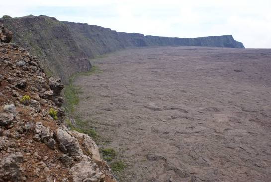
    The Enclos Fouqué is the caldera (a vast depression formed by the collapse of the summit) where most of the Piton de la Fournaise's activity is concentrated today. Its lower part, on the ocean side, forms the Grand Brûlé.

    • A caldera open to the ocean

      Unlike a closed crater, the Enclos is wide open on its south-eastern side, allowing lava flows to run straight down to the sea.

    • The Pas de Bellecombe viewpoint

      Its ramparts (cliff walls) offer the best view over the whole Enclos and its various volcanic cones.

    • The heart of the activity

      Almost all of the volcano's recent eruptions take place inside this vast enclosure.

    Did you know? It is named after the French geologist Fouqué, who studied the volcano in the 19th century.

    Photo: App photo library · Internal use

    Pas de Bellecombe-Jacob
    2,311 m

    07

    Pas de Bellecombe-Jacob

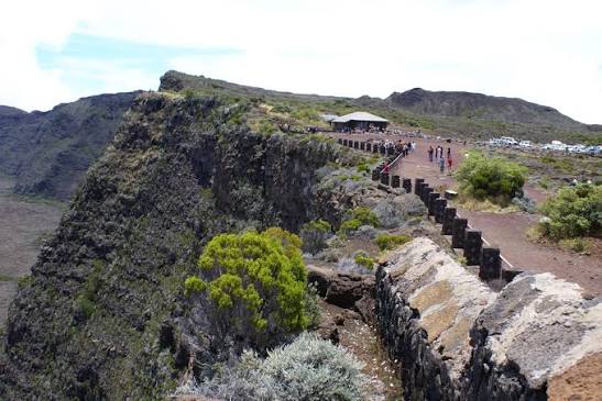
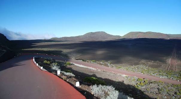
    The best-known and busiest viewpoint over the Piton de la Fournaise: a lookout at 2,311 metres, on the edge of the ramparts (cliff walls) overlooking the Enclos Fouqué.

    • The iconic panorama

      At a single glance you take in the whole Enclos, the main crater and often the Formica Leo below.

    • Early-morning mists

      Early in the morning, clouds rising from the Plaines give the site a particularly dramatic feel, before clearing during the day.

    • Where the trails begin

      This is where the main hiking trails to the summit and the Dolomieu crater begin.

    Did you know? The name honours Bellecombe-Jacob, governor of Île Bourbon in the 18th century.

    Photo: App photo library · Internal use

    Formica Leo

    08

    Formica Leo

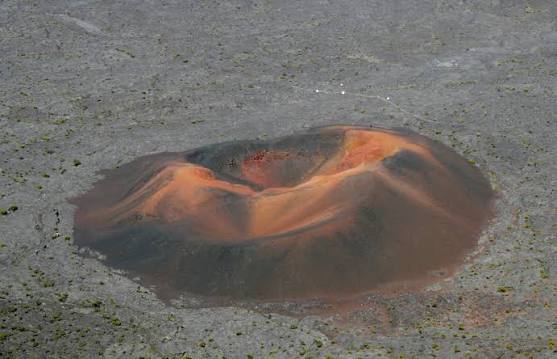
    A small red volcanic cone about thirty metres high, nestled at the bottom of the Enclos Fouqué and reachable on foot from the Pas de Bellecombe in around twenty minutes.

    • A miniature cone

      Formed by an old secondary eruption, its reddish-orange colour stands out against the black of the rest of the Enclos.

    • A short, accessible hike

      It is one of the easiest walks from Bellecombe, popular with families in good weather.

    • A curious name

      “Formica Leo” actually refers to the funnel-shaped trap of the antlion; the shape of the cone earned it this nickname.

    Did you know? Walking around the Formica Leo takes only about ten minutes, making it one of the shortest “hikes” on the whole island.

    Photo: App photo library · Internal use

    Plaine des Sables

    09

    Plaine des Sables

    A plateau of volcanic origin with a lunar, desert-like landscape, crossed by the volcano road between Bourg-Murat and the Pas de Bellecombe: one of the most spectacular and otherworldly stretches on the island.

    • A Martian landscape

      This plateau of reddish-orange ash and scoria has almost no vegetation, in total contrast with the rest of the island.

    • An unmissable stage

      Every visitor heading to the volcano crosses the Plaine des Sables, a striking foretaste of the volcanic scenery to come.

    • A UNESCO-listed site

      Like the rest of the volcano massif, the Plaine des Sables is part of the “Pitons, cirques and remparts” World Heritage property.

    Did you know? The contrast is so striking that some visitors compare crossing the Plaine des Sables to a space mission, without ever leaving solid ground.

    Photo: App photo library · Internal use

    How the three cirques formed

    10

    How the three cirques formed

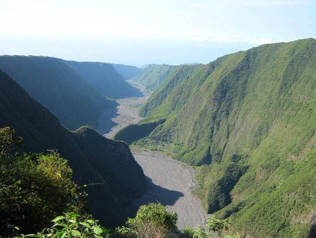
    Cilaos, Mafate and Salazie are not craters but immense amphitheatres carved by erosion around the former Piton des Neiges volcano over hundreds of thousands of years.

    • A collapse, not an explosion

      The cirques result from the gradual subsidence of the Piton des Neiges' flanks, combined with intense erosion caused by heavy tropical rainfall.

    • The role of water

      Over millennia, rivers rushing down the slopes carved ever deeper valleys, until they formed today's dizzying ramparts (cliff walls).

    • Three cirques, three faces

      Despite a shared origin, Cilaos, Mafate and Salazie each have their own climate and vegetation, depending on their exposure to wind and rain.

    Did you know? Seen from the sky, the three cirques form a three-leaf clover shape around the Piton des Neiges, clearly visible today on aerial and satellite photos.

    Photo: Jean-Louis Sicot · Wikimedia Commons · CC BY-SA 4.0

    Cirque de Cilaos
    Formed ~350,000 years ago

    11

    Cirque de Cilaos

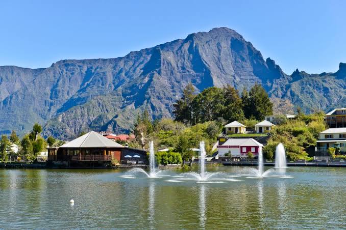
    Reachable by car along a winding mountain road, Cilaos grew up around its hot springs and its isolation, at the heart of a cirque (natural amphitheatre) ringed by dizzying peaks.

    • Hot springs

      Discovered in the 19th century, they gave rise to the spa village and its former treatment centre.

    • A tightly enclosed cirque

      The Trois Salazes and the ramparts encircling Cilaos make it one of the most vertiginous landscapes on the island.

    • A land apart

      Lentils, wine and embroidery from Cilaos have become emblematic products of this isolated cirque.

    Did you know? Before the road was built in 1932, it took several days on foot to reach Cilaos from the coast.

    Photo: App photo library · Internal use

    Cirque de Mafate
    No roads at all

    12

    Cirque de Mafate

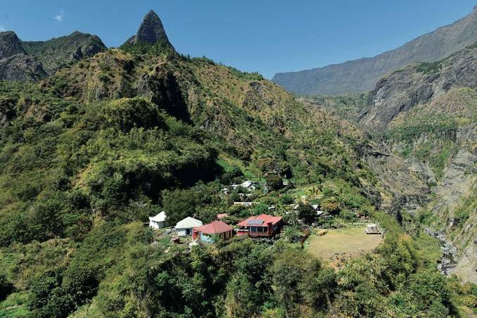
    With no roads at all, Mafate can only be explored on foot or by helicopter. The cirque first served as a refuge for maroons (escaped enslaved people) before its first inhabited îlets (hamlets) appeared.

    • A refuge for maroons

      The cirque's name is said to come from a Malagasy maroon, a leader and healer who took refuge in these mountains in the 18th century.

    • Isolated hamlets

      Marla, Roche-Plate, La Nouvelle... each îlet can only be reached on foot, some after several hours of walking.

    • A UNESCO heritage site

      Mafate lies in the core of Réunion National Park and within the “Pitons, cirques and remparts” World Heritage property.

    Did you know? Everything that comes into Mafate, from food to building materials, has to be carried on people's backs, flown in by helicopter or brought by cable.

    Photo: App photo library · Internal use

    Cirque de Salazie
    Officially named in 1835

    13

    Cirque de Salazie

    The greenest of the three cirques, known for its vanilla and chouchou (chayote) crops, and for the Voile de la Mariée waterfall tumbling down its cliff.

    • The Voile de la Mariée (Bridal Veil)

      This iconic waterfall cascades down the cirque's ramparts right at the entrance to Salazie, visible from the road.

    • A very rainy climate

      It is the wettest of the three cirques, which explains its particularly lush vegetation.

    • Hell-Bourg

      The village of Hell-Bourg, at the heart of the cirque, is one of the only overseas villages listed among the Most Beautiful Villages of France.

    Did you know? The name Salazie is said to come from the Malagasy “Soalazy”, thought to mean a three-legged cooking pot; the cirque was long nicknamed “good camp”.

    Photo: App photo library · Internal use

    The Grand Brûlé

    14

    The Grand Brûlé

    The coastal part of the Enclos Fouqué, between Sainte-Rose and Saint-Philippe: a vast expanse of solidified lava where nature is gradually reclaiming its ground, crossed by the legendary Route des Laves.

    • 32 km of the Route des Laves

      The RN2 crosses the Grand Brûlé for about 32 km between Sainte-Rose and Saint-Philippe, with signs showing the year of each lava flow it passes over.

    • Nature bouncing back fast

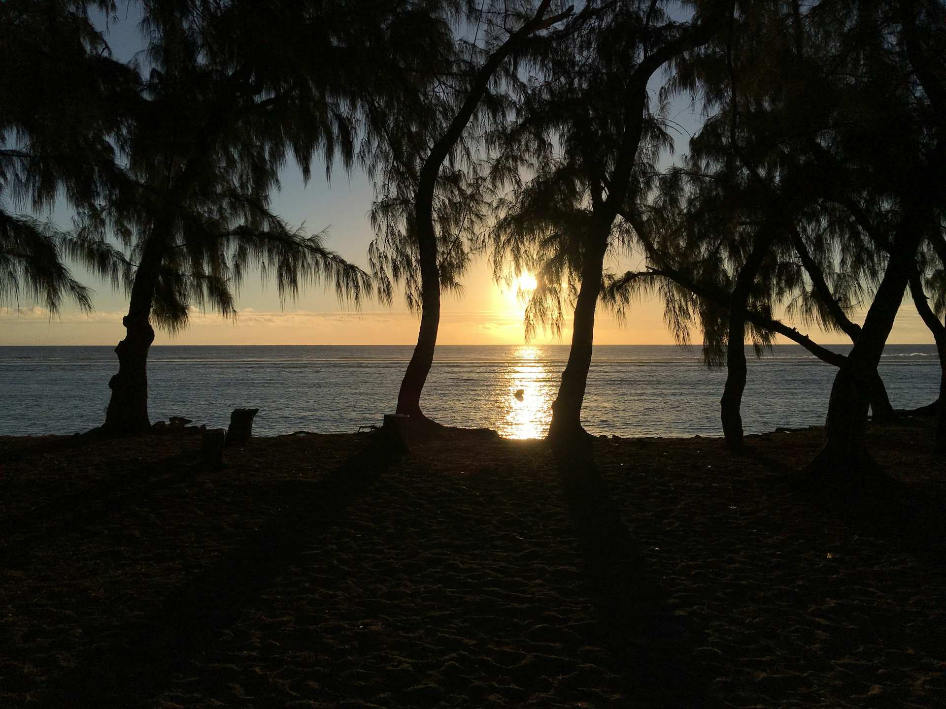
      Ferns, shrubs and filaos (casuarina trees) grow back within just a few years on the most recent flows.

    • A road regularly cut off

      In 1977, 1986, 2002, 2007 and 2026, lava flows crossed the road, forcing a long detour via Saint-Denis to get from the south to the east.

    Did you know? After the 2007 eruption, it took seven months of work to reopen the road, buried in places under more than 60 metres of solidified lava.

    Photo: Thierry Caro · Wikimedia Commons · CC BY-SA 3.0

    The volcano road

    15

    The volcano road

    The road linking Bourg-Murat to the Pas de Bellecombe via the Plaine des Sables: one of the most spectacular drives on the island, passing through forests, volcanic plains and lunar landscapes in just a few kilometres.

    • From forest to desert

      In less than an hour's drive, the scenery changes from tamarind forests to the entirely mineral Plaine des Sables.

    • La Cité du Volcan

      In Bourg-Murat, where the road begins, this museum helps you prepare your visit by explaining the volcano's geological history.

    • The end of the road

      The road ends at the Pas de Bellecombe car park, the gateway to all the trails to the summit.

    Did you know? The road is sometimes closed by prefectural order during an eruption or when there is a volcanic risk, so always check its status before setting off.

    Photo: App photo library · Internal use

    Hikes on the volcano

    See all

    The official app

    All of Nout Péi, in your pocket

    The website opens the doors. The app comes with you out in the field: map, guides, routes, and Quiz Péi, available only in the app.

    • Quiz PéiDaily challenge, duels and leaderboard
    • Scan PéiIdentify what you discover
    • Interactive mapEvery place in your pocket
    • In-depth guidesHistory, trails, local favourites

    Open this page in your browser

    This app’s built-in browser blocks the App Store. Tap ··· in the top right corner, then “Open in browser”, and tap the download button again.