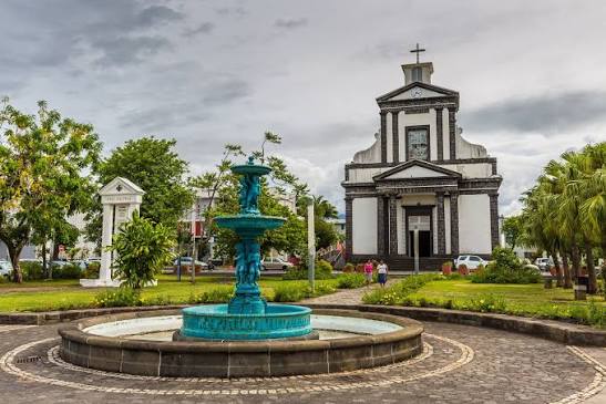
Town on Réunion Island
Saint-Benoît
A large municipality in the east, stretching from the coast to the Hauts (uplands), with a humid climate, many rivers and a rich natural and religious heritage.
Where the name comes from
Founded in 1730 by Governor Pierre Benoît Dumas, the town bears his middle name. Crossed by the Rivière des Marsouins, it long made its living loading coffee and then sugar cane on its quays.
History
Saint-Benoît is the administrative and economic capital of Réunion's east coast. Founded in the 17th century on a coast battered by the trade winds and easterly rains, the municipality was long cut off from the rest of the island by raging rivers and impassable ravines. It was not until the 20th century that the RN2 main road found its way around the natural obstacles of the north-east.
The municipality is crossed by the Rivière des Marsouins, whose catchment records some of the highest rainfall on the planet — up to 12,000 mm a year in some areas. This abundance of water fuelled an intensive sugar industry: the Beaufonds factory, now disused, was one of the largest on the east coast in the 19th century.
Today the regional centre of the east coast, Saint-Benoît has a hospital, several secondary schools, decentralised government services and a lively covered market. The humid tropical forests covering its uplands — including the Trou de Fer, a dizzying 200 m-deep chasm reached from Salazie — lie within the core area of Réunion National Park.
Landscapes
Saint-Benoît is shaped by extreme rainfall that feeds powerful rivers and one of the densest humid tropical forests in Europe. The municipality's uplands form a maze of ravines, waterfalls and cloud forests. The coastline is exposed to easterly swells and the trade winds, forming a rocky, poorly sheltered shore.
Local culture
Saint-Benoît is the cultural capital of the east coast, with a maritime tradition of inshore fishing and a Creole culture deeply rooted in the memory of the sugar plantations. The municipality is a starting point for expeditions into the tropical forest and hikes to the Bébour-Bélouve forest, the ecological jewel of eastern Réunion.
Why it matters
Grand Étang, Bassin Bleu and the Église Sainte-Anne: a municipality that brings together humid volcanic landscapes, tropical forests and iconic religious architecture.
Photo: App photo library · Internal use
Sources (1)
- https://www.insee.fr/fr/statistiques/1405599?geo=DEP-974+COM-97410